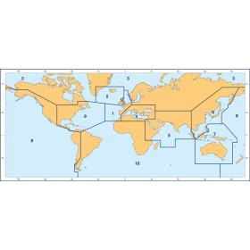
Description
France's Naval Hydrographic and Oceanographic Service charts cover waters for many areas of the world, providing commercial and recreational mariners with important navigational information.
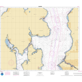
Specifications
- Paper Length: 45"
- Paper Width: 36"
- Edition Number: 3
- Edition Date: 07/05/2016
- Scale: 1:3,500,000
- Content Width: 27.183"
- Content Length: 41.817"
Rebates
There are currently no rebates available for this item


You may also like
-

BA-1683 Plans on the South and East Coasts of Peloponnisos
-
BA-3892 Beihai Gang to Hailingshan Gang including Qiongzhou Haixia
-

SHOM Nautical Chart 7398 - Rade de Brest (partie Ouest) - Baie de Roscanvel - Anse du Fret
-

NOAA Nautical Chart - 16608OG Shelikof Strait-Cape Douglas to Cape Nukshak
-
NOAA Nautical Chart - 18446OG Puget Sound-Apple Cove Point to Keyport, Agate Passage