Description
Commercial and recreational boaters alike know that nothing replaces the peace of mind that comes from having a reliable paper chart onboard. These charts are printed on high-quality paper and feature improved detailing and color contrast.
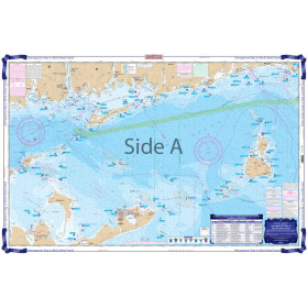
The chart you are viewing is NOT updated weekly and does NOT include all of the latest Notice to Mariners corrections.
- Chart Length: 45"
- Paper Width: 36"
- Scale: 20000
- Content Width: 41.398"
- Content Length: 32.79"
Specifications
Nautical Chart Selector - Select a region from the map below to view other charts

Rebates
There are currently no rebates available for this item
You may also like
-
Waterproof Charts - Narragansett Bay to Block Island Sound Fishing
-

NOAA Nautical Chart - 19358 Southeast Coast of Oahu Waimanalo Bay to Diamond Head
-

NOAA Nautical Chart - 19016 Ni'ihau to French Frigate Shoals;Necker Island;Nihoa
-

NOAA Nautical Chart - 18685 Monterey Bay;Monterey Harbor;Moss Landing Harbor;Santa Cruz Small Craft Harbor
-

NOAA Nautical Chart - 12335 Hudson and East Rivers Governors Island to 67th Street