Description
Size: 48" x 36"
Scale: 80,000
Edition Date: 11/04/2011
Edition Number: 2
LNM Cleared Date: 01/06/2017
Specifications
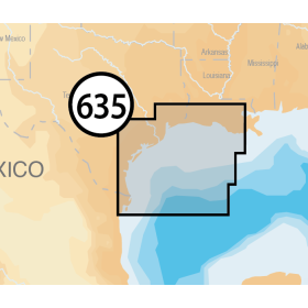
Nautical Chart Selector - Select a region from the map below to view other charts

Rebates
There are currently no rebates available for this item
You may also like
-
Navionics Platinum+ XL 635P+ - West Gulf of Mexico
-

NOAA Nautical Chart - 18473 Puget Sound-Oak Bay to Shilshole Bay
-

NOAA Nautical Chart - 18458 Hood Canal-South Point to Quatsap Point including Dabob Bay
-

NOAA Nautical Chart - 11322 Intracoastal Waterway Galveston Bay to Cedar Lakes
-

NOAA Nautical Chart - 17376 Tebenkof Bay and Port Malmesbury