Description
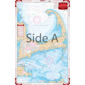
A great combination of 4 government charts! Covers Massachusetts Bay from Provincetown to Beverly on one side, withdetails for Salem Sound, Scituate Harbor, and Manchester Harbor. The reverse side provides detailed coverage of Boston Harbor from Cohasset to Winthrop.
Specifications
Rebates
There are currently no rebates available for this item
You may also like
-
Navionics Platinum+ XL3 32P+ - Mediterranean West
-
NOAA Nautical Chart - 18772 Approaches to San Diego Bay
-
NOAA Nautical Chart - 13396 Campobello Island; Eastport Harbor
-
NHS Nautical Chart - NHS038 Trondheimsleia Terningen - Kyrkseterora - orlandet
Regular Price: $32.50
Special Price $24.75
-
CHS Nautical Chart - CHS4857 Indian Bay to / a Wadham Islands
