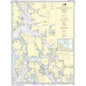
Description
France's Naval Hydrographic and Oceanographic Service charts cover waters for many areas of the world, providing commercial and recreational mariners with important navigational information.
Specifications
- Paper Length: 49"
- Paper Width: 36"
- Edition Number: 2
- Edition Date: 07/20/2015
- Scale: 1:15,000
- Content Width: 32.09"
- Content Length: 45.763"
Rebates
There are currently no rebates available for this item
You may also like
-

NGA Nautical Chart - 26267 Great Inagua Island and Little Inagua Island
-

Imray Nautical Chart - Imray-C33B Channel Islands and North Coast of France
-

NOAA Nautical Chart - 19347 Channels between Molokai Maui Lana'i and Kaho'olawe;Manele Bay
-
NOAA Nautical Chart - 17360 Etolin Island to Midway Islands including Sumner Strait;Holkham Bay;Big Castle Island
-

NOAA Nautical Chart - 16511 Inanudak Bay and Nikolski Bay Umnak l.;River and Mueller Coves