Description
France's Naval Hydrographic and Oceanographic Service charts cover waters for many areas of the world, providing commercial and recreational mariners with important navigational information.
Specifications
- Paper Length: 48"
- Paper Width: 36"
- Edition Number: 6
- Edition Date: 07/19/2018
- Scale: 1:74,300
- Content Width: 44.297"
- Content Length: 32.077"
Rebates
There are currently no rebates available for this item
You may also like
-

NOAA Nautical Chart - 11359 Loop Deepwater Port Louisiana Offshore Oil Port
-
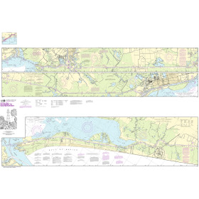
NOAA Nautical Chart - 11331 Intracoastal Waterway Ellender to Galveston Bay
-
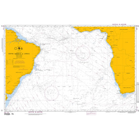
NGA Nautical Chart - 22 South America to Africa
-
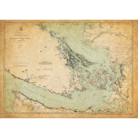
Historical Nautical Chart - cp3678c Georgia Strait and Strait of Juan Defuca
Regular Price: $45.00
Special Price $39.95
-

CHS Nautical Chart - CHS5630 Dunne Foxe Island to/a Chesterfield Inlet