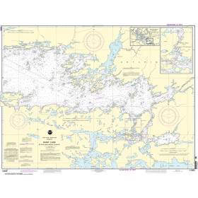
Description
France's Naval Hydrographic and Oceanographic Service charts cover waters for many areas of the world, providing commercial and recreational mariners with important navigational information.
Specifications
- Paper Length: 49"
- Paper Width: 36"
- Edition Number: 3
- Edition Date: 07/06/2017
- Scale: 1:20,000
- Content Width: 31.617"
- Content Length: 45.807"
Rebates
There are currently no rebates available for this item
You may also like
-

CHS Nautical Chart - CHS3939 Fisher Channel to/a Seaforth Channel and/et Dean Channel
-

NOAA Nautical Chart - 18685 Monterey Bay;Monterey Harbor;Moss Landing Harbor;Santa Cruz Small Craft Harbor
-

NOAA Nautical Chart - 11503 St. Marys Entrance Cumberland Sound and Kings Bay
-

NOAA Nautical Chart - 17325 South and West Coasts of Kruzof Island
-
NOAA Nautical Chart - 14996 Rainy Lake-Big Island Minn. to Oakpoint Island Ont.;Kettle Falls