Description
Commercial and recreational boaters alike know that nothing replaces the peace of mind that comes from having a reliable paper chart onboard. These charts are printed on high-quality paper and feature improved detailing and color contrast.
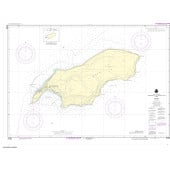
The chart you are viewing is NOT updated weekly and does NOT include all of the latest Notice to Mariners corrections.
- Chart Length: 51"
- Paper Width: 36"
- Scale: 100000
- Content Width: 34.458"
- Content Length: 47.615"
Specifications
Nautical Chart Selector - Select a region from the map below to view other charts

Rebates
There are currently no rebates available for this item


You may also like
-

NGA Nautical Chart - 24028 Gulf of Paria to Maroni River (Northeast Coast-South America)
-

SHOM Nautical Chart 7283 - Des îles Fidji (Fiji) aux îles Tonga - Iles Wallis et Futuna
-

SHOM Nautical Chart 7355 - Hiva-Oa Tahuata et Mohotani - HivaOaTahuataMohotaniFatuHuku
-

NOAA Nautical Chart - 81054 Mariana Islands Apra Harbor Guam
-

NOAA Nautical Chart - 25677 South Coast of Puerto Rico Guanica Light to Punta Tuna Light;Las Mareas