Description
Commercial and recreational boaters alike know that nothing replaces the peace of mind that comes from having a reliable paper chart onboard. These charts are printed on high-quality paper and feature improved detailing and color contrast.
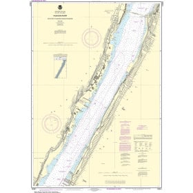
The chart you are viewing is NOT updated weekly and does NOT include all of the latest Notice to Mariners corrections.
- Chart Length: 50"
- Paper Width: 36"
- Scale: 25000
- Content Width: 31.18"
- Content Length: 46.063"
Specifications
Nautical Chart Selector - Select a region from the map below to view other charts

Rebates
There are currently no rebates available for this item
You may also like
-

Navionics Paper HotMaps West Point Lake - SOUTH AL
-
NOAA Nautical Chart - 12341 Hudson River Days Point to George Washington Bridge
-

NOAA Nautical Chart - 11360 Cape St. George to Mississippi Passes
-

NGA Nautical Chart - 81345 Mortlock Islands (East Caroline Islands)
-

NGA Nautical Chart - 25723 Approaches to Bahia de Samana