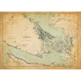
Description
Size: 49" x 36"
Scale: 80,000
Edition Date: 07/01/2005
Edition Number: 2
LNM Cleared Date: 06/03/2016
Specifications
Nautical Chart Selector - Select a region from the map below to view other charts

Rebates
There are currently no rebates available for this item
Related Products
Related Accessories


You may also like
-

NOAA Nautical Chart - 11359 Loop Deepwater Port Louisiana Offshore Oil Port
-
Historical Nautical Chart - cp3678c Georgia Strait and Strait of Juan Defuca
Regular Price: $45.00
Special Price $39.95
-

Historical Nautical Chart - 19357-12-1974 Island Of Oahu
Regular Price: $45.00
Special Price $39.95
-

CHS Nautical Chart - CHS4583 St. Julien Island to / a Hooping Harbour including / y compris Canada Bay
-

BA-3358 Approaches to Shuidong Gangqu and Bohe Gangqu