Description
by John and Leslie Kettlewell
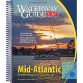
ISBN: 0071803904, 9780071803908, All the charts and waypoints, bridge and anchorage guidance you need to navigate the ICW -in one, updated volume. Now in its 6th Edition a this is THE one chart guide you need as backup to your electronic navigation. Spiral bound, 304 pages. Pub 2012. The new edition includes all the latest charts, still in our unique "flip-chart" format. Just start at page one and proceed down the entire ICW, flipping from page to page all in order. This is still the handiest way to follow along as you proceed down the Waterway, but if you also use an electronic chart plotter this book is a perfect companion to it. Let the electronics keep track of exactly where you are a while you use the chartbook to look ahead and plan for what is coming up. Or use the chartbook to look for a marina, fuel dock, or anchorage for the night. New in this edition a we've identified the locations of marinas right on the charts, and then in a listing we provide GPS coordinates and the marina phone numbers. Of course we also locate hundreds of great anchorages on the charts, and provide brief descriptions in the back. and a as before they include all the major alternate routes, like the Dismal Swamp Canal and Umbrella Cut, as well as charts to get you in and out of all the major inlets. Includes Inlets and Major Side Channels:
Specifications
Rebates
There are currently no rebates available for this item